June 2024 / PADDLING
Looking upstream on the Hudson from the Sherman Island boat launch. Rich Macha
Spier Falls section of the Hudson River from the Western Ridge Trail in Moreau Lake State Park. Rich Macha
Quieter and Wilder Side of Saratoga County
By Rich Macha
While I can think of many paddling destinations in Saratoga County, and bordering counties with the Hudson and Mohawk Rivers (including Champlain and Erie canals), many are dominated by motorboats, have development along shorelines, and/or have busy roads nearby. So where can you go to find quieter and wilder waters in the Saratoga and Glens Falls region to get in a few miles of paddling? Two spots come to mind, the Hudson River on either side of the Spier Falls Dam, and the Kayaderosseras Creek along with Lake Lonely Outlet.
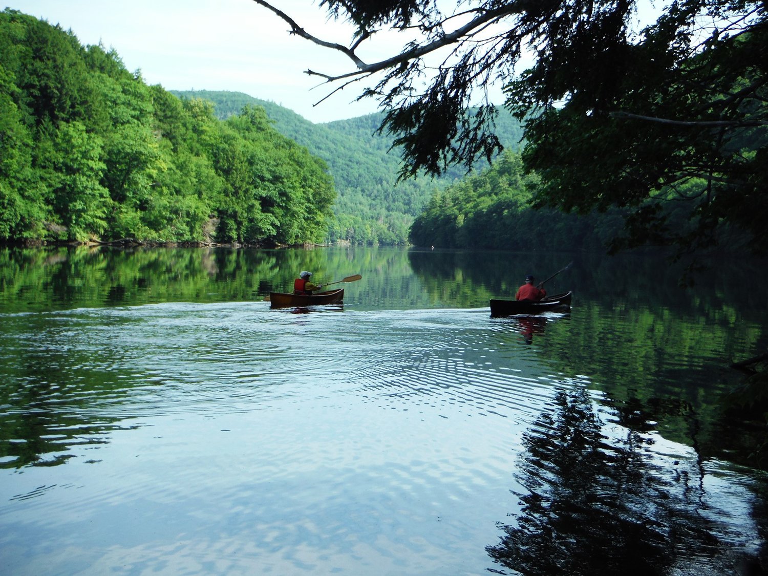
Hudson River from Sherman Island Boat Launch – From NY Route 9 near South Glens Falls, drive west on Spier Falls Road (CR 24) for 3.4 miles and take a right into the gravel boat launch which is a part of Moreau Lake State Park. While motorboats are allowed on this section of the river, they are seldom seen, most likely because there are only 3.5 miles of river between dams.
Paddling downstream, to the right from the boat launch, you at once notice how the river cuts through steep forested hills on both sides – the Palmertown Range rises on the right, and the Luzerne Mountains (including the West Mountain ski and outdoor center) to the left.
After paddling about 1.5 miles, the river bends to the right and passes by some rocky promontories, a rocky island, and hidden coves on the south shore – spend some time exploring this fascinating area. If it has been windy on the main river, you will have protection in the coves. The Sherman Island Dam is a short distance downstream, so turn around well short of it and head back – the current is usually mild. And, hopefully, you don’t have a strong headwind coming from the southwest.
After passing by the boat launch, you can then paddle past islands for a little over a mile to the Spier Falls Dam – there will be some road noise from vehicles passing by on Spier Falls Road, but the dam is interesting in that at the time it was built in 1903 it was the fourth largest dam in the world. Head back to the boat launch for a round-trip of six to seven miles.
For those who would like to combine a paddle with a hike in Moreau Lake State Park, it is possible to walk across the road from the launch and hike up to the Western Ridge Trail via the Cottage Park Trail – there are several lookouts along the ridge where you can view the river below as well as gaze into the southern Adirondacks.
For those wanting more paddling, drive 2.7 miles further west on Spier Falls Road to the Spier Falls Boat Launch. The Moreau Lake State Park trail map (PDF) shows the river, boat launches, and hiking trails: parks.ny.gov. You can also find it here: friendsofmoreaulake.org. According to the map, if you have a lightweight canoe or kayak, you can use the portage trail on the northside to get around the Spier Falls Dam.
Heading toward the Sherman Island Dam. Rich Macha
Moreau Lake – In the main section of the state park, the lake can be a pleasant non-motorized spot to paddle, especially if you would like to do some fishing, picnicking, or combine it with a swim at the beach (with new food/drink options). The pond is fairly small so you are not going to do any kind of mileage on it, and the beach may be busy on most sunny summer days. However, the water is very clear, and it can be attractive for a short cloudy or early/late day paddle.
Lake Lonely Outlet. Rich Macha
Hudson River from Spier Falls Boat Launch – Again, motorboats are allowed on this five-mile section of the river, however, there is only room to park five or six vehicles with trailers, so the river won’t be overrun with motors.
Paddling downstream, soon passing an area of bedrock that seems to jut out into the river from the south shore, it is about a mile to the top of Spier Falls Dam.
Paddling upstream from the boat launch, you pull away from civilization. The north shore is still part of the state park for a couple of miles and the forest consists mainly of deciduous trees, while the south shore is comprised of conifers.
After going about three miles, a smokestack and paper mill are seen on the south shore. You may then notice an increase in the current and that the water becomes somewhat squirrely as you approach the Palmer Falls Dam in Corinth – it is best to turn back here, if not sooner. On the return, the Palmertown Range dominates the scenery to the southeast, rising 700 feet above the river.
In summer, many wildflowers can be seen dotting the shores and shallows of the river; look for cardinal flower (red), buttonbush (white), pickerelweed (purple), blue flag iris, closed gentian (blue), and more. If you’re lucky, you may find some blueberries and huckleberries too. Watchable wildlife can include anything from dragonflies to whitetail deer to families of common mergansers.
Lake Lonely Outlet. Rich Macha
Kayaderosseras Creek and Lake Lonely Outlet – The Kayaderosseras is a lovely meandering lowland stream. The three-mile stretch between the Northway (I-87) and Saratoga Lake is often paddled, and a side trip up and down Lake Lonely Outlet can add another couple of miles.
A good access point is a small beach at Waterfront Park on Crescent Avenue. This does require paddling along the north side of Saratoga Lake for a half-mile to reach the mouth of the “K” – this may be less desirable on a windy day or during the height of the motorboating season so stay close to shore.
An alternate put-in, just upstream from the mouth of the creek, can be found at the Arrowhead Casino Archaeological Preserve at the end of Arrowhead Road, 0.7 miles from Crescent Ave. You will have to carry your boat along a trail for up to 200 yards and it may be muddy, although possibly less so slightly downstream to the left.
For a fee, you can launch at the boat shop on Crescent Avenue where the road crosses over Lake Lonely Outlet. You can then paddle 0.9 miles downstream to meet the Kayaderosseras at a point one mile from Saratoga Lake.
For a more detailed description of the Kayaderosseras, check out my Adirondack Sports article in the April 2019 issue: adksports.com/2019-04-paddling.
The above wilder and quieter paddles are all a short drive from the Capital, Saratoga and Glens Falls region. A good guidebook that covers Saratoga County and areas to the west, north, and east is Russell Dunn’s A Kayaker’s Guide to Lake George, The Saratoga Region & Great Sacandaga Lake.
A lover of wild places, Rich Macha has led many trips for the Adirondack Mountain Club and has spent 20 years in the paddle/snowsport business. For more of Rich’s adventures, visit: northeastwild.blogspot.com.